The Avenues & Capitol Hill, Salt Lake City, UT

What The Avenues & Capitol Hill is actually like
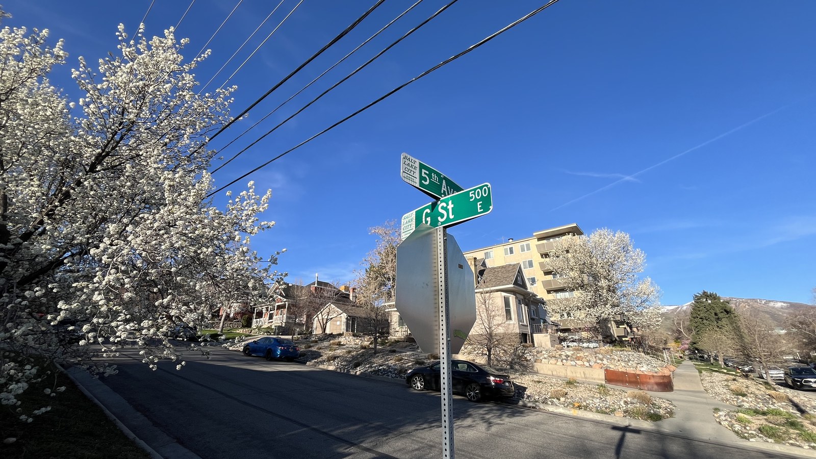
The Avenues was the first section of Salt Lake City to depart from the original ten-acre block grid laid out in 1847; its irregular, smaller-block survey from the early 1850s actually violated territorial law until the legislature passed a new ordinance in 1860 authorizing it. North-south streets first carried tree names, then were relettered A through V (V becoming Virginia Street) by 1885, while the east-west streets -- originally named for things like "Fruit" and "Garden" -- weren't formally renumbered as First through Eighteenth Avenues until 1907, giving the neighborhood its name (Wikipedia). By the turn of the century the district had become a streetcar suburb for the city's middle and upper-middle class, a character its Victorian and bungalow housing stock still shows.
Capitol Hill, the smaller district just west of the Avenues, takes its name from its defining building: the Utah State Capitol, designed by architect Richard K.A. Kletting, broke ground December 26, 1912, and was dedicated October 9, 1916, at an original cost of roughly $2.74 million (Wikipedia). The Capitol got its most consequential recent addition almost a century later, not architecturally but structurally: a 2004-2008, $260 million renovation installed a base-isolation seismic system with 280 isolators designed to let the entire building rock gently on its foundation during an earthquake up to magnitude 7.3, a direct response to the Wasatch Fault running a few miles east. Just west of the Capitol, the smaller Marmalade district takes its own name from apricot and pear orchards planted there in the early 20th century (Salt Lake City Council District 3).
The 2020 census counted 16,378 residents in the Avenues with a median household income of $103,475 (Wikipedia), and Walk Score separately tallies 15,851 residents in its own "Greater Avenues" boundary and 7,943 in Capitol Hill (Walk Score, Walk Score) -- a reminder that neighborhood boundaries here are drawn differently by different sources, not a discrepancy in any one figure.
Home values in The Avenues & Capitol Hill
Redfin's median sale price for The Avenues neighborhood was $883,574 over the three months ending August 2026, up 6.5% year-over-year (Redfin) -- notably above the citywide figures elsewhere in this cluster, consistent with the district's historic housing stock, hillside views, and proximity to downtown. Utah levies a flat 4.45% individual income tax rate on all residents regardless of income level, plus a 6.10% state sales tax rate that combines with local option taxes for a statewide average combined rate of 7.19% (Tax Foundation) -- the actual rate paid at the register varies by city and county. Property taxes run the other direction and carry Utah's signature structural break for owner-occupants: the state's constitutional primary residential exemption shields 45% of a primary, owner-occupied home's fair market value from taxation entirely, so only 55% of assessed value is actually taxed -- automatic for most owner-occupied homes, with no age or income requirement attached, though a Residential Property Declaration must be filed within 90 days of a county assessor's notice to keep it (Utah State Tax Commission). That exemption is a structural reason Utah's statewide average effective property tax rate runs low even before any single homeowner does anything: Tax Foundation puts it at 0.48% of home value, AskDoss's own homeowner-facing guide puts it at roughly 0.55% -- both well below the national average, with the small gap ordinary source-to-source variance rather than a real disagreement about the underlying rate (Tax Foundation, AskDoss). Rocky Mountain Power, a division of PacifiCorp, is the dominant electric utility across the Salt Lake Valley and most of the Wasatch Front, serving more than 1.2 million customers combined across Utah, Wyoming, and Idaho, with Utah its largest single-state customer base (Rocky Mountain Power).
Evenings and weekends
The Avenues and Capitol Hill run on coffee and dinner hours, not late nights. Avenues Proper Restaurant & Publick House (376 E 8th Ave), a brewpub with its own beer list, is close to the only real bar here (Visit Salt Lake); Hatch Family Chocolates and Publik's Third Avenue cafe sit nearby but keep daytime and after-work hours rather than evening ones. In Marmalade, Lucky Ones Coffee anchors the district's small commercial cluster near the Capitol on the same kind of schedule (Park Record). Most streets are purely residential and quiet well before 10 p.m., a function of small hillside lots rather than any single closure. There's no walkable bar row here -- people wanting one head downhill into downtown, less than a mile south of the Capitol, or catch a bus down to Main Street.
Getting around
Both the Avenues and Capitol Hill score meaningfully above Salt Lake City's citywide 59 Walk Score -- 62 and 60 respectively -- and LDS Hospital sits inside the Avenues itself, a genuine walk-to landmark rather than a several-mile drive. The hillside grid means steeper walks than downtown's flat blocks, and neither district sits directly on TRAX, so a car or bus is still the practical way to reach destinations beyond downtown's edge.
The Avenues & Capitol Hill FAQ
Is the Avenues walkable?
Reasonably -- Walk Score's Greater Avenues page scores it 62 ("Somewhat Walkable"), above Salt Lake City's citywide 59, and Capitol Hill scores 60 with a 70 Bike Score. The hillside grid means steeper walks than downtown's flat blocks.
Why do the Avenues have lettered streets?
The neighborhood's original 1850s survey broke from Salt Lake City's standard grid, and its north-south streets were relettered A through Virginia by 1885. The east-west cross streets weren't formally renamed First through Eighteenth Avenue until 1907 -- which is where the district's name comes from.
Is the Utah State Capitol earthquake-safe?
It's had real seismic work done: a 2004-2008, $260 million renovation added a 280-isolator base-isolation system designed to let the building rock gently on its foundation during an earthquake up to magnitude 7.3, a direct response to the nearby Wasatch Fault.
Does this area flood?
City Creek Canyon runs along the Avenues' eastern edge and was the source of downtown's 1983 flood, when the city had to convert State Street into a sandbagged channel. Under normal conditions this isn't an active flood risk, but the Wasatch Fault -- underscored by the Capitol's own seismic retrofit -- is the district's real structural hazard.
What is the Marmalade district?
A small neighborhood just west of the Capitol, named for the apricot and pear orchards planted there in the early 20th century. Traces of that agricultural history remain in local parks and street names.
How much do homes cost in the Avenues?
Redfin's median sale price for the Avenues was $883,574 over the three months ending August 2026, up 6.5% year-over-year -- notably above other Salt Lake City districts in this cluster, reflecting its historic housing stock and hillside views.
Nearby alternatives*We're not ranking these — every place has real trade-offs, and which ones matter is up to you.
Downtown & Central City
Directly south and downhill -- Temple Square sits less than a mile from the Capitol, and City Creek Canyon connects both districts' shared 1983 flood history.
Sugar House
Several miles southeast across downtown -- a flatter, more commercially dense district with a very different housing stock and its own S-Line streetcar connection.
Sandy
About 15 miles south via I-15 or TRAX -- one of Utah's largest suburbs, with home values and lot sizes well outside the Avenues' dense, historic hillside blocks.
See what makes Salt Lake City stand out — verified, named medical, dietary, sports, and other specialty resources you won't find in most metros.
Explore Specialty Resources →