Johns Island, Charleston, SC

What Johns Island is actually like
Before English colonists arrived, the Kiawah, Stono, and Bohicket peoples were already settled and farming along Johns Island's tidal creeks. Colonial settlement began in the 1670s, and by the time surveyors drew maps of the island in 1695 and 1711, plantations lined the banks of the Stono River growing indigo with enslaved labor -- the direct root of the Gullah Geechee community that still lives on the island today (Wikipedia).
The single event that most defines Johns Island's history happened there on September 9, 1739: roughly 20 enslaved people met near the Stono River, led by a man named Jemmy, raided a store at the Stono Bridge, killed two shopkeepers, and marched south toward Spanish Florida, gathering more people as they went. The Stono Rebellion remains the largest uprising by enslaved people in Britain's mainland North American colonies (Wikipedia). That same community's descendants built landmarks that still stand on the island -- Hebron Presbyterian Church, raised in 1868 from shipwreck timber by formerly enslaved carpenters, and the Progressive Club, founded in 1948 by civil rights organizer Esau Jenkins.
The 2020 Census counted 28,344 residents across Johns Island's ZIP codes, and the island's own population grew 50% between 2000 and 2010 alone -- "the largest increase in the island's history" (zip-codes.com, Wikipedia). Johns Island is still unincorporated -- roughly a third of its 84 square miles sits inside Charleston's city limits, with the rest under Charleston County jurisdiction directly -- and that growth hasn't slowed: recent zoning fights over density along the Maybank Highway corridor are now a regular fixture of county council meetings.
Home values in Johns Island
RealtyTrac's own market data for ZIP 29455 (Johns Island) put the median listing price at $749,000 as of July 2026, down 3.97% year-over-year from $780,000 in August 2025 -- while the median SOLD price for the same stretch was $916,400, up 16.98%, a gap that reflects how thin the closing sample gets at this scale (a handful of unusually high- or low-priced sales can swing a monthly median) more than a clean read on where prices are heading (RealtyTrac). Separately, city-data.com's 2024 estimate for the broader Johns Island area put median household income at $101,529 (up from $40,877 in 2000) and median home value at $577,664 (up from $115,200 in 2000) (city-data.com). South Carolina taxes an owner-occupied primary residence at a 4% assessment ratio and everything else -- second homes, rentals, most LLC-owned property -- at 6%; every property defaults to the 6% rate when it changes hands, and a new owner has to file for the legal-residence exemption to get to 4% (Nat Wallen). St. John's Water Company, a private nonprofit utility chartered in 1975, supplies drinking water to most of Johns Island plus Kiawah and Seabrook islands, buying its own supply wholesale from Charleston Water System -- but it doesn't handle wastewater, so septic systems remain common outside the newest subdivisions (St. John's Water Company). Electric service splits by address between at least two providers serving Charleston County, Dominion Energy and Berkeley Electric Cooperative; confirm the exact utility for a specific parcel before buying (Berkeley Electric Cooperative, Charleston's Finest).
Evenings and weekends
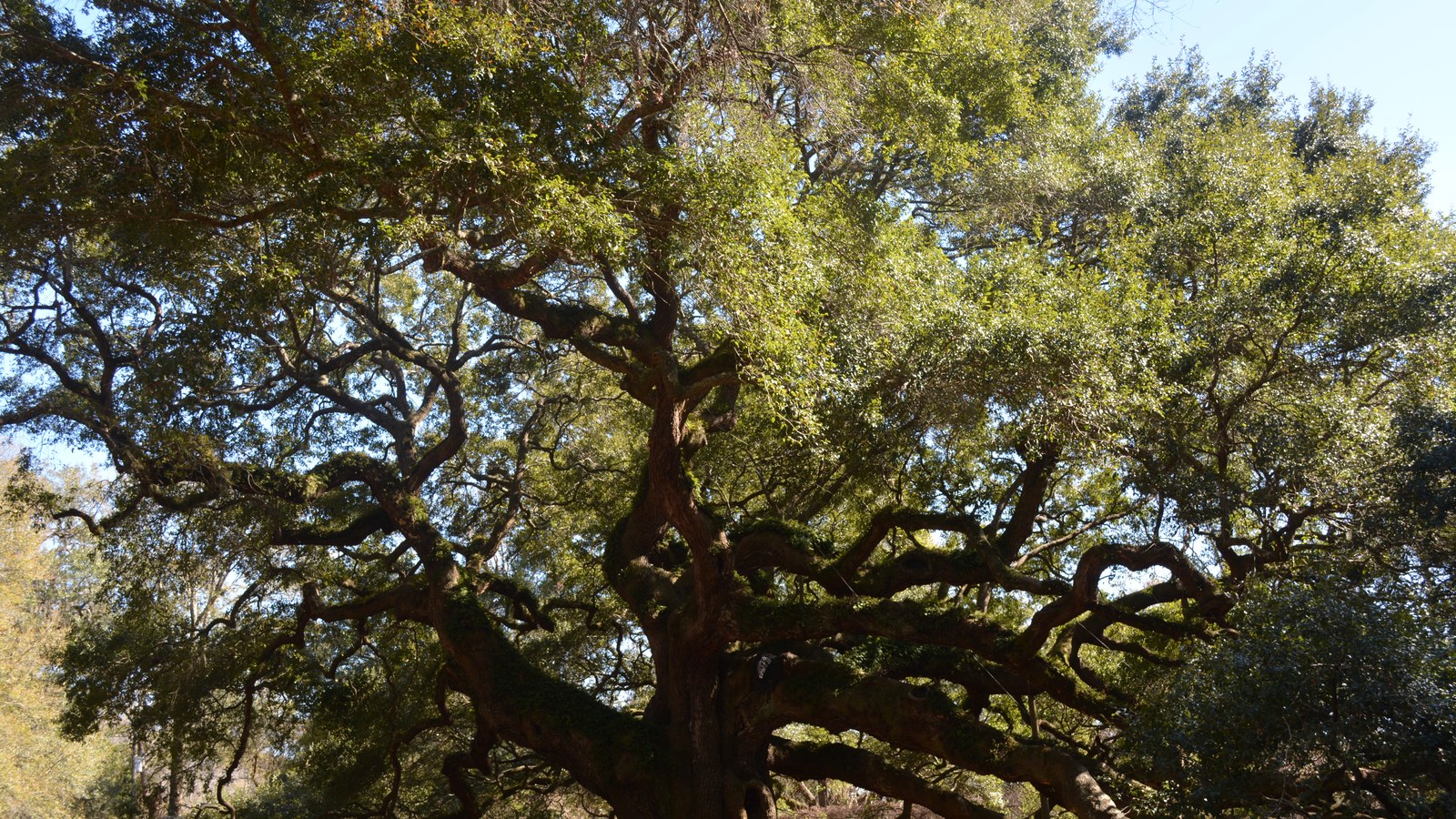
Johns Island's version of a night out is farm-based rather than bar-based. Legare Farms has grown produce on the island since 1725 and still runs seasonal events and a farm stand off Main Road, and Joseph Fields Farm, a third-generation Gullah Geechee organic operation, sells directly to Charleston-area shoppers and restaurants. Charleston County's own planning director has said the majority of the East Coast's tomato crop once came out of the Johns Island and Wadmalaw Island area -- a former DiMare tomato-packing plant on Main Road, vacant for 15 years, is being redeveloped into a $21 million, 190,000-square-foot commercial park called Vine Works Trade Park (Post and Courier). Further down Maybank and Bohicket roads, on neighboring Wadmalaw Island, the Charleston Tea Garden and Firefly Distillery draw a steady stream of weekend visitors through Johns Island's own crossroads. Back on the island itself, the Angel Oak -- a live oak estimated at 400 to 500 years old -- sits inside Angel Oak Park, within Charleston's city limits.
Getting around
Nearly all of Johns Island's roughly 30,000 residents rely on a single corridor, Maybank Highway (SC-700), to reach the rest of the metro -- two lanes with no center turn lane and no paved shoulder along significant stretches, carrying commuters, Kiawah- and Seabrook-bound tourists, and commercial trucks together (Roden Law). Every one of those vehicles funnels across the same two-lane Stono River bridge; a 2007 "pitchfork plan" to add two relief roads branching off Maybank Highway near that bridge has stalled for years on funding gaps (roughly $3 million left of an original $15 million budget) and conflicts with drainage ponds planned for the long-delayed I-526 completion (Post and Courier). The commute into downtown via Maybank Highway to Folly Road typically runs 20-30 minutes off-peak and 45-60-plus minutes during the 7-9 a.m. and 4-6:30 p.m. rush windows; River Road to Bohicket Road to US-17 is the usual alternate for the island's northern end, reaching West Ashley and the airport without crossing the same bridge (locatingchs.com). CARTA's free DASH trolley doesn't extend past the historic peninsula, so confirm current county bus coverage for a specific address rather than assuming transit reaches a given part of the island (CARTA).
Johns Island FAQ
Is Johns Island part of the City of Charleston?
Only partly -- roughly a third of the island's 84 square miles sits inside Charleston's city limits, with the rest unincorporated Charleston County. There's no separate town or city of Johns Island; Charleston City Council and Charleston County Council share zoning authority depending on the parcel.
What was the Stono Rebellion, and why does it matter to Johns Island's history?
On September 9, 1739, roughly 20 enslaved people met near the Stono River on Johns Island, led by a man named Jemmy, raided a store at the Stono Bridge, and marched south toward Spanish Florida -- the largest uprising by enslaved people in Britain's mainland North American colonies. It grew directly out of the indigo and rice plantations already mapped on Johns Island by 1695 and 1711, worked by the enslaved population whose descendants make up today's Gullah Geechee community on the island.
Is Johns Island still an agricultural place?
Yes, alongside fast residential growth -- Legare Farms has operated since 1725, and Joseph Fields Farm is a third-generation Gullah Geechee organic operation still selling locally. Charleston County's own planning director has said the majority of the East Coast's tomato crop once came out of the Johns Island and Wadmalaw Island area; a former tomato-packing plant on Main Road, vacant for 15 years, is now being redeveloped into a $21 million commercial park.
Why is Johns Island's growth so contested?
Charleston County unanimously rejected a Cane Slash Road rezoning request in September 2025 after more than 300 written comments opposed it over traffic and infrastructure strain -- one of several recent fights over density on an island where every vehicle in or out crosses a single two-lane Stono River bridge. Confirm the current zoning and any pending applications for a specific parcel before buying.
Does Johns Island flood?
Yes -- rapid development has paved over land that used to absorb rainfall, and the City of Charleston's $6.1 million Dale Morris Ecological Park, the largest nature-based flood project in South Carolina, was built specifically to slow runoff from a creek that regularly floods roughly 1,700 nearby housing units. Check FEMA flood zone maps for a specific address; risk varies by block and elevation.
What's the deal with well and septic systems on Johns Island?
St. John's Water Company, a private nonprofit utility chartered in 1975, supplies drinking water to most of Johns Island plus Kiawah and Seabrook islands, buying its supply wholesale from Charleston Water System -- but it doesn't provide wastewater service, so septic systems remain common outside the newest developments. Confirm water and sewer service for a specific address before buying.
Nearby alternatives*We're not ranking these — every place has real trade-offs, and which ones matter is up to you.
James Island
Directly across the Stono River bridge via Maybank Highway, the same corridor Johns Island shares to reach downtown -- home to James Island County Park along the Stono River.
West Ashley
Reached via Main Road (US-17) without crossing the Stono River bridge into downtown -- Charleston's largest suburb by population, with older mid-century subdivisions alongside newer growth of its own.
Folly Beach
Further out via Maybank Highway then Folly Road -- a separate barrier-island beach town on the Atlantic, with its own city government and the metro's most popular surf break.
See what makes Charleston stand out — verified, named medical, dietary, sports, and other specialty resources you won't find in most metros.
Explore Specialty Resources →