North Charleston, SC
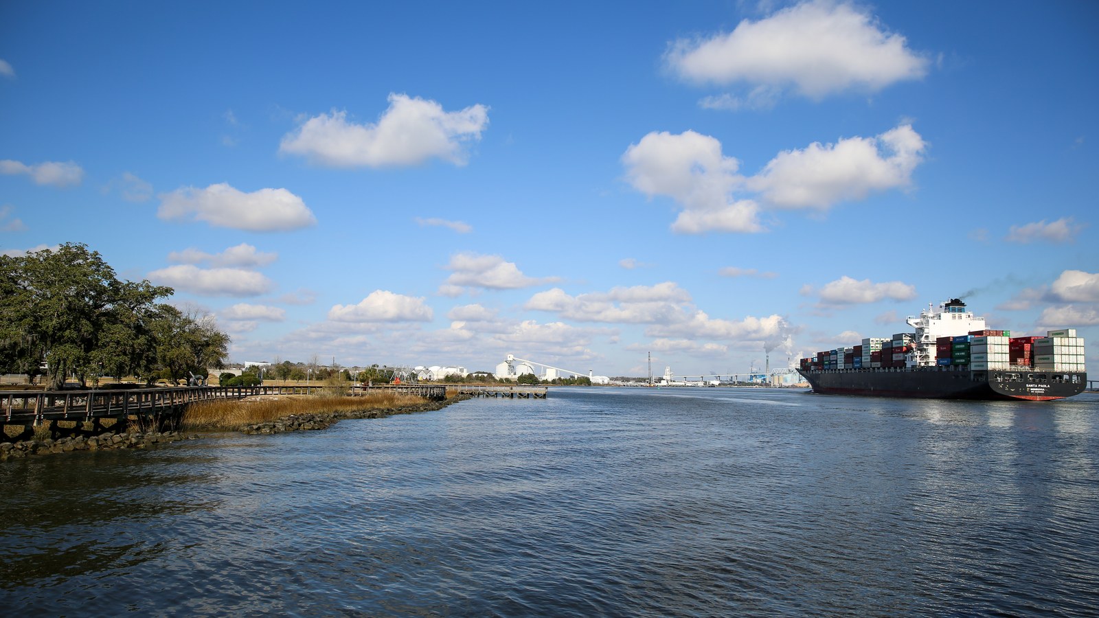
.jpg)
What North Charleston is actually like
North Charleston isn't a neighborhood that grew up around a city -- it's a city that was built, on paper, in a single afternoon. Voters approved incorporation on April 27, 1971, and the city was formally chartered on June 12, 1972, with John E. Bourne Jr. as its first mayor, starting out as South Carolina's 9th-largest city. It didn't stay that size for long: within six months, the new city annexed the Charleston Naval Base, the adjoining Air Force Base, and Charleston International Airport, jumping to the state's 4th-largest city and growing from roughly 22,000 to 53,000 residents in a single year (City of North Charleston).
The single institution that shaped North Charleston more than any other was the Charleston Naval Shipyard, which the Navy began building on about 1,189 acres in 1901 and grew into the state's largest civilian employer -- peaking at more than 36,000 workers in 1983, roughly a third of them civilians, supporting Cold War submarine refits and the Polaris missile program (Post and Courier). A 1993 federal base-closure round ended nearly a century of that history: the base closed on April 1, 1996, at a cost the city put at about $1.4 billion in lost annual economic activity (City of North Charleston). Redevelopment has been gradual rather than instant -- Riverfront Park opened on part of the waterfront in 2005, the Navy Yard Charleston mixed-use district and the Hugh K. Leatherman Terminal container port both came online in 2021, and the base's flight line and remaining acreage became a roughly 24,000-acre joint Air Force-Navy installation in 2010, known as Joint Base Charleston until it was renamed Joint Base Lindsey Graham in August 2026 (Wikipedia). Boeing added a second major anchor in October 2009, announcing what became the 787 Dreamliner final-assembly campus known as Boeing South Carolina.
The U.S. Census Bureau's own 2025 estimate (V2025) puts North Charleston at 129,245 residents, up from 114,852 at the 2020 Census -- growth of about 12.5% in five years, spread across 77.62 square miles of the coastal plain (U.S. Census Bureau). That makes it South Carolina's third-largest city, behind Columbia and the City of Charleston itself -- not ahead of Charleston, despite a land area more than nine times the size of Charleston's historic peninsula. The city's limits reach into Charleston, Dorchester, and Berkeley counties, though its historic core and city hall sit in Charleston County.
Home values in North Charleston
RealtyTrac's own market data for ZIP 29405 -- covering North Charleston's older core near Park Circle, close to city hall -- put the median listing price at $399,400 as of July 2026, down 1.37% year-over-year, while the median sold price was $312,100, down 5.93% (RealtyTrac). North Charleston spans several ZIP codes across three counties, so prices vary considerably by block and by how close a property sits to the port, the airport, or Boeing's campus; 29405 is used here only as one representative sample, not a citywide figure. Walk Score puts the city's overall walkability at 26, a "Car-Dependent" rating -- most errands require a car, and the city "does not have many bike lanes" per its own Bike Score of 38 (Walk Score). South Carolina taxes an owner-occupied primary residence at a 4% assessment ratio and everything else -- second homes, rentals, most LLC-owned property -- at 6%; every property defaults to the 6% rate when it changes hands, and a new owner has to file for the legal-residence exemption to get to 4% (Nat Wallen). That assessed value is then multiplied by the local millage rate rather than a flat statewide percentage; South Carolina's statewide average effective property tax rate on owner-occupied housing is 0.49%, alongside a 6.00% state sales tax (7.49% average combined with local option taxes) and a graduated income tax topping out at 5.21% (Tax Foundation). Dominion Energy is the primary electric and gas provider, though parts of the city -- which spans Berkeley and Dorchester counties as well as Charleston County -- fall under Berkeley Electric Cooperative or Santee Cooper instead; water comes from Charleston Water System in the Charleston County portion and Dorchester County Water & Sewer further out, with sewer service split between those providers and the North Charleston Sewer District (Charleston's Finest). Confirm the exact providers for a specific address before budgeting for utilities here.
Evenings and weekends
The closest thing North Charleston has to a dining-and-events district is Park Circle, a traffic-circle-anchored neighborhood the Olmsted Brothers helped plan starting around 1914 as part of the original streetcar-suburb layout for the area (Charleston County Public Library). Riverfront Park, opened in 2005 on part of the former Naval Base's Cooper River waterfront, gives the city a public green space directly on the water where the shipyard used to stand. For shopping, Centre Pointe and the Tanger Outlets complex at 4840 Tanger Outlet Boulevard -- near Ashley Phosphate Road -- runs 90 brand-name outlet stores alongside big-box retailers like Ashley Furniture and Staples and a mix of chain and local restaurants, and is promoted as being about fifteen minutes from most of the metro (Visit North Charleston). Riverfront Park also hosts the High Water Festival each spring, a two-day music festival that drew national-touring headliners including Lord Huron, Mt. Joy, Arcade Fire, and Counting Crows to its 2025 lineup -- founded by Charleston natives Cary Ann Hearst and Michael Trent of the band Shovels & Rope, the festival passed to promoter C3 Presents starting with that 2025 edition (Post and Courier).
Getting around
North Charleston's own Walk Score of 26 ("Car-Dependent") and Bike Score of 38 ("Somewhat Bikeable") mean a car is the default way to get around outside a few older grid neighborhoods (Walk Score). The city's 1972 annexation of Charleston International Airport means the metro's only commercial airport sits inside North Charleston's own limits, and I-26 and I-526 both run through the city, connecting it to the rest of the metro and to the Port of Charleston's Hugh K. Leatherman Terminal, which opened on former Naval Base land in April 2021. Distance to downtown Charleston depends heavily on where in this 77.62-square-mile city you start: the nearest edge, near the old Navy Base, is a roughly 5.8-mile, 9-minute drive, while a more typical trip from central North Charleston via I-26 runs 15-20 minutes off-peak and 30-45 minutes or more during morning and evening rush hour (Rome2Rio, LocatingCHS). Trident Medical Center, a 321-licensed-bed hospital at 9330 Medical Plaza Drive that opened in 1975, is the major hospital located inside the city (Wikipedia).
North Charleston FAQ
Is North Charleston walkable?
Not particularly -- North Charleston's citywide Walk Score is 26, a "Car-Dependent" rating, with most errands requiring a car and a citywide Bike Score of 38. Walkability is better within older grid neighborhoods like Park Circle than along the city's arterial corridors.
When did North Charleston become its own city, and why is it called that?
North Charleston incorporated on June 12, 1972, after an April 27, 1971 referendum, with John E. Bourne Jr. as its first mayor -- named simply for lying north of Charleston. Within six months it annexed the former Naval Base, the Air Force Base, and Charleston International Airport, jumping from the state's 9th-largest city to its 4th-largest and from about 22,000 to 53,000 residents in a single year.
What happened to the Charleston Naval Base?
The Charleston Naval Shipyard opened in 1901 and grew into the region's largest employer, supporting up to 36,000 workers by 1983 during Cold War submarine operations, before closing on April 1, 1996 under a federal base-closure round. Its roughly 1,189 acres have since been redeveloping piecemeal into Riverfront Park (2005), the Navy Yard Charleston mixed-use district, and the Hugh K. Leatherman Terminal, which opened in April 2021.
Does North Charleston flood?
Yes, though the city's flood risk centers on inland tidal creeks rather than the harbor tides that flood the Charleston peninsula -- Filbin Creek flooded significantly during Hurricane Matthew in 2016, and the city has since begun formal watershed master-planning for Filbin Creek, Noisette Creek, and Quitman's Marsh. Check FEMA flood maps for a specific address; risk varies with proximity to these creek systems.
How far is North Charleston from downtown Charleston?
It depends on where in the city you start -- North Charleston covers 77.62 square miles. The nearest edge, near the old Navy Base, is under 6 miles and about a 9-minute drive; from more central parts of the city via I-26, plan on 15-20 minutes off-peak and 30-45 minutes, sometimes longer, during rush hour.
Which school district serves North Charleston?
Most of the city is in Charleston County School District, but the slice of North Charleston that falls in Dorchester County is zoned to Dorchester School District Two. Confirm the exact zoned schools for a specific address via each district's attendance-boundary maps.
Nearby alternatives*We're not ranking these — every place has real trade-offs, and which ones matter is up to you.
West Ashley
Southwest across the Ashley River -- Charleston's largest suburb by population, with older mid-century subdivisions alongside newer growth toward the Stono River.
Hanahan
Just northeast via I-526 -- a smaller Berkeley County city of about 20,325 residents at the 2020 Census, incorporated in 1973, partly home to the Naval Consolidated Brig Charleston.
Ladson
West via I-26 -- an unincorporated community of about 15,550 residents at the 2020 Census, spanning Berkeley, Charleston, and Dorchester counties along the I-26/US-78 corridor.
See what makes Charleston stand out — verified, named medical, dietary, sports, and other specialty resources you won't find in most metros.
Explore Specialty Resources →