Mount Pleasant, SC

What Mount Pleasant is actually like
Before English settlement, the Sewee people inhabited the marsh and pine woods east of the Cooper River. European settlement nearby began July 6, 1680, when Captain Florentine O'Sullivan led colonists onto a roughly 2,340-acre grant the earliest maps labeled "North Point" -- the barrier island just offshore still carries his name, Sullivan's Island. The town itself grew out of two separate villages: planter Jonathan Scott laid out Greenwich, the first hamlet, on 100 acres in 1766, platting King, Queen, and Pitt Streets, and ferry operator James Hibben bought the adjoining "Mount Pleasant" plantation in 1803 and laid out Mount Pleasant Village next to his landing. The two merged in 1837 into the town of Mount Pleasant (Charleston MLS, Wikipedia).
For most of its history Mount Pleasant was reachable from Charleston only by ferry across the Cooper River. The Grace Memorial Bridge, a narrow cantilever truss span originally tolled at $1, opened in 1929 as the first fixed link; the Silas N. Pearman Bridge followed alongside it in 1966. Both were replaced on July 16, 2005 by the Arthur Ravenel Jr. Bridge, an eight-lane, 13,200-foot cable-stayed span named for the retired congressman who helped secure its roughly $700 million in funding -- and it's that bridge, plus the highway growth it fed, that turned a small ferry town into the metro's largest suburb: 30,108 residents in 1990, 67,843 by 2010, 90,801 at the 2020 Census (South Carolina Historical Society, Wikipedia).
The U.S. Census Bureau's own July 2025 estimate puts Mount Pleasant at 95,469 residents -- up 4.9% from the 2020 Census count in just five years -- spread across 49.53 square miles, with a median household income of $124,755 and a median home value of $748,500 (U.S. Census Bureau, QuickFacts, 2025).
Home values in Mount Pleasant
RealtyTrac's own market data for ZIP 29464 -- the older, southern half of town that includes Old Village and Shem Creek -- put the median listing price at $1.1 million as of July 2026, down 3.70% year-over-year, while the median SOLD price was $1.0 million, up 4.61% (RealtyTrac). Across ZIP 29466, the newer, northern half of town that includes I'On, the median listing price was $877.5K, down 1.35%, and the median SOLD price was $880.7K, up 5.57%, over the same twelve months (RealtyTrac). Mount Pleasant's own townwide Walk Score is 22, "Car-Dependent" -- Walk Score's own description notes that almost all errands require a car, far below the 93 that downtown Charleston's historic peninsula scores just across the bridge (Walk Score). South Carolina taxes an owner-occupied primary residence at a 4% assessment ratio and everything else -- second homes, rentals, most LLC-owned property -- at 6%, the same statewide rule that applies across the whole Charleston metro; every property defaults to the 6% rate when it changes hands, and a new owner has to file for the legal-residence exemption to get to 4% (Nat Wallen). That assessed value is then multiplied by the local millage rate rather than a flat statewide percentage, so the actual bill varies block to block; South Carolina's statewide average effective property tax rate on owner-occupied housing is 0.49%, well below the national average, alongside a 6.00% state sales tax (7.49% average combined with local option taxes) and a graduated income tax topping out at 5.21% (Tax Foundation). Dominion Energy is the electric utility; water and sewer come from Mount Pleasant Waterworks, a local utility separate from the Charleston Water System that serves the peninsula (utilitiesformyhome.com).
Evenings and weekends
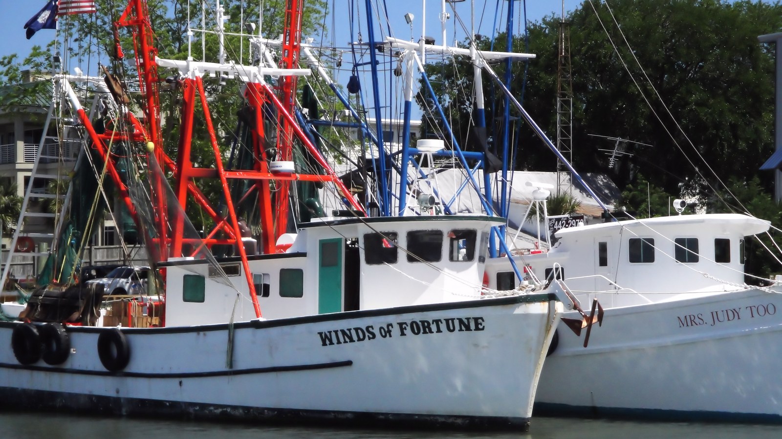
Shem Creek's evening scene runs on top of a real shrimping fleet, not instead of one. A navigation beacon went in at the creek's mouth in 1905 to guide boats into what mariners already recognized as the best sheltered-harbor alternative to the main Charleston peninsula, and commercial shrimp trawling itself began in 1930, when Captain C. Magwood first worked ocean shrimp out of the creek (Town of Mount Pleasant). The fleet grew to roughly 70 trawlers at its peak, supported after 1957 by Moultrie Fisheries' ice plant, which could turn out up to 100 tons of ice a day; only about 10 trawlers were still working the creek by 2011. Moultrie Fisheries itself closed in 1989, and its building reopened as Red's Ice House, now one of the restaurants and bars -- Red's sits at 98 Church St -- that line the docks alongside the boats still unloading there (Shem Creek Restaurants). It's a short walk or a two-minute drive from Coleman Blvd, and it's Mount Pleasant's closest thing to a walkable night out, even though the rest of the town runs on cars.
Getting around
Mount Pleasant's townwide Walk Score is 22, "Car-Dependent," and its dining and retail sit along corridors like Coleman Blvd and US-17 rather than in a walkable core -- Walk Score counts an average of just 0.4 restaurants, bars, and coffee shops within a 5-minute walk of a typical address townwide, despite roughly 230 total dining and drinking spots across the town (Walk Score). Two crossings carry most of the traffic in and out: the Arthur Ravenel Jr. Bridge (US-17) into downtown Charleston, and the Ben Sawyer Bridge onto Sullivan's Island, which continues on to Isle of Palms (Wikipedia). CARTA runs local bus routes into Mount Pleasant, though nothing like downtown's dedicated DASH trolley network -- confirm current routes and schedules directly with CARTA for a specific commute. Novant Health East Cooper Medical Center, a roughly 130-licensed-bed hospital at 2000 Hospital Drive, has served the town since 1986 (originally as AMI East Cooper Community Hospital) and joined the Novant Health system in February 2024, having previously been part of Tenet Health (Novant Health, CareListings).
Mount Pleasant FAQ
Is Mount Pleasant a good place to live, and is it walkable?
Mount Pleasant is Charleston's largest and most affluent suburb, with a median household income of $124,755 and a median home value of $748,500 as of the Census Bureau's 2025 estimate -- but it's built for cars, not feet: the town's overall Walk Score is 22, "Car-Dependent," versus 93 on the Charleston peninsula just across the bridge. Old Village and I'On are more walkable than most of the rest of town; confirm walkability for a specific address before assuming it holds townwide.
What's the story behind the Arthur Ravenel Jr. Bridge?
For most of its history Mount Pleasant was reachable from Charleston only by ferry. The Grace Memorial Bridge, opened in 1929, was the first fixed link; the Silas N. Pearman Bridge followed in 1966; both were replaced on July 16, 2005 by the Arthur Ravenel Jr. Bridge, an eight-lane, 13,200-foot cable-stayed span carrying roughly 96,300 vehicles a day as of 2018.
What happened to Shem Creek's shrimping fleet?
Commercial shrimp trawling began at Shem Creek in 1930, and the fleet grew to roughly 70 trawlers at its peak, supported from 1957 by Moultrie Fisheries' ice plant. Only about 10 trawlers remained by 2011, and Moultrie Fisheries itself closed in 1989 -- its building reopened as Red's Ice House, now one of several restaurants and bars that line the docks alongside the boats still unloading there.
What is I'On, and is it typical of the rest of Mount Pleasant?
I'On is a New Urbanist neighborhood begun April 30, 1995 by developer Vince Graham and designed by Dover, Kohl & Partners and Duany Plater-Zyberk & Company -- about 762 single-family homes on a walkable, front-porch street grid around a village square, a deliberate contrast to the car-oriented, cul-de-sac subdivisions that make up most of the rest of the town.
Does Mount Pleasant flood?
Yes, particularly in low-lying, marsh-front sections. A 2025 town study found 23% of Mount Pleasant sits below 7 feet in elevation, with Haddrell Point near Shem Creek and Darrell Creek off the Wando River flagged as most vulnerable -- a combined roughly $10.8 million in projected economic losses between the two areas by 2050 under a 10-year-storm-plus-high-tide scenario. Check FEMA flood zone maps for a specific address; risk varies block to block.
How many people live in Mount Pleasant, and how fast is it growing?
The U.S. Census Bureau's July 2025 estimate puts Mount Pleasant at 95,469 residents, up from 90,801 at the 2020 Census and just 30,108 in 1990 -- growth driven largely by the Ravenel Bridge and the highway network that followed it.
Nearby alternatives*We're not ranking these — every place has real trade-offs, and which ones matter is up to you.
Isle of Palms & Sullivan's Island
Barrier-island beach towns connected to Mount Pleasant by the Ben Sawyer Bridge, anchored by Fort Moultrie, the palmetto-log fort that repelled a British invasion fleet on June 28, 1776.
Daniel Island
A master-planned community between the Cooper and Wando rivers -- technically in Berkeley County, but functioning as an extension of Mount Pleasant since development began in 1996, and now home to Credit One Stadium's professional tennis.
Downtown Charleston
Across the Cooper River via the same Arthur Ravenel Jr. Bridge -- the walkable, flood-studied historic peninsula the rest of the metro is measured against.
See what makes Charleston stand out — verified, named medical, dietary, sports, and other specialty resources you won't find in most metros.
Explore Specialty Resources →