Goose Creek, SC

What Goose Creek is actually like
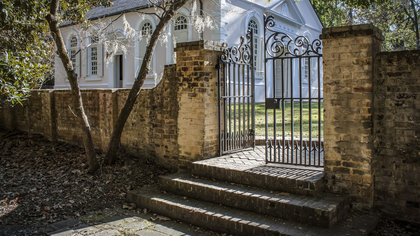
Goose Creek takes its name from the winding, goose-neck-shaped waterway English settlers found when they arrived in the early 1670s -- many of them planters from Barbados, granted land along the creek and known collectively as the "Goose Creek Men," who became a powerful bloc in the young colony's government. The Anglican parish of St. James Goose Creek was established in 1706, and its church, completed by 1719, still stands today and is listed on the National Register of Historic Places -- one of the oldest surviving buildings in South Carolina. By 1790, the parish counted 2,787 residents, most of them enslaved people working its rice plantations (South Carolina Encyclopedia, Wikipedia).
That plantation economy collapsed after the Civil War, and hurricanes in the late 19th and early 20th centuries finished the job, destroying the dikes that kept the rice fields workable and reducing the area to a few hundred residents (South Carolina Encyclopedia, Post and Courier). What turned Goose Creek back around was the Navy: the U.S. Ammunition Depot opened here in November 1941, became the Naval Weapons Station in 1959, and the city incorporated in 1961 specifically to manage the growth building up around it. When the city annexed the Naval Weapons Station in 1978, the population jumped from 3,656 residents in 1970 to 17,811 by 1980 -- nearly fivefold in a single decade (South Carolina Encyclopedia). In 2010, the Naval Weapons Station merged with Charleston Air Force Base to form Joint Base Lindsey Graham, now more than 20,877 acres supporting roughly 79,000 personnel across 53 military commands, most of it still inside Goose Creek's city limits (Wikipedia).
The U.S. Census Bureau's own estimate puts Goose Creek at 52,010 residents as of July 1, 2025, up from 45,946 at the 2020 Census -- growth that has made it Berkeley County's largest city and, per local reporting, South Carolina's eighth-largest (U.S. Census Bureau, Post and Courier). The city covers roughly 41 square miles of land, bordered to the east by the Cooper River and the Back River (Wikipedia).
Home values in Goose Creek
RealtyTrac's own market data for ZIP 29445 put the median listing price at $340,000 as of May 2026, up 4.61% year-over-year, while the median SOLD price for the same stretch was $321,500, down 0.98% -- both well below the Charleston peninsula's own numbers, consistent with Goose Creek's role as a working- and middle-class commuter suburb rather than a luxury market (RealtyTrac). Goose Creek doesn't have a dense walkable core the way downtown Charleston does -- the city is built around arterial roads like Goose Creek Boulevard connecting subdivisions, retail strips, and Joint Base Lindsey Graham, and most errands here require a car. South Carolina taxes an owner-occupied primary residence at a 4% assessment ratio and everything else -- second homes, rentals, most LLC-owned property -- at 6%; every property defaults to the 6% rate when it changes hands, and a new owner has to file for the legal-residence exemption to get to 4% (Nat Wallen). That assessed value is then multiplied by the local millage rate rather than a flat statewide percentage, so the actual bill varies by taxing district; South Carolina's statewide average effective property tax rate on owner-occupied housing is 0.49%, well below the national average, alongside a 6.00% state sales tax (7.49% average combined with local option taxes) and a graduated income tax topping out at 5.21% (Tax Foundation). Berkeley Electric Cooperative is the electric utility serving Goose Creek along with the rest of Berkeley, Charleston, and Dorchester counties; water and sewer service splits by address between the City of Goose Creek's own Public Works utility and Berkeley County Water and Sanitation, so confirm the provider for a specific property (Berkeley Electric Cooperative, Berkeley County Water and Sanitation).
Evenings and weekends
Goose Creek doesn't have a King Street-style nightlife strip -- its two National Register historic sites, St. James Church (completed 1719) and the Otranto Plantation Indigo Vats, are the closest thing to a tourist draw, both remnants of the rice- and indigo-plantation economy that predates the Navy town by two centuries (Wikipedia). Day-to-day life here runs more around Joint Base Lindsey Graham and its roughly 79,000 personnel than around a commercial district built for visitors: restaurants, retail, and services cluster along the city's arterial roads rather than a single walkable center, serving the subdivisions and military families nearby (Wikipedia). The Cooper River and Back River along the city's eastern edge give boaters and anglers water access without the tidal congestion of the downtown peninsula.
Getting around
Goose Creek is roughly 18 miles from downtown Charleston, typically a 23-minute drive via I-26, with North Charleston sitting about at the halfway point (Distance-Cities.com). There's no trolley or rail line here comparable to downtown's DASH service -- Goose Creek is built for driving, and most residents commute by car both within the city and into Charleston or North Charleston for work. The nearest hospital is Trident Medical Center, a 321-licensed-bed hospital at 9330 Medical Plaza Drive in neighboring North Charleston, founded in 1975 (Wikipedia). Goose Creek's low, flat elevation (about 13 feet) and its Cooper River and Back River frontage mean parts of the city carry real flood exposure, though the better-documented hazard story here is historical rather than an ongoing tidal pattern: hurricanes in the late 19th and early 20th centuries destroyed the dikes that had made the area's old rice plantations viable, a major factor in the area's decades-long decline before the Navy arrived (South Carolina Encyclopedia). Check FEMA's Flood Map Service Center for a specific address; risk varies by block and proximity to the rivers.
Goose Creek FAQ
Is Goose Creek a good place to live?
It's a car-dependent, working- and middle-class commuter suburb rather than a walkable destination -- Berkeley County's largest city, with a 2025 Census Bureau estimate of 52,010 residents, built around Joint Base Lindsey Graham and its own subdivisions rather than a dense downtown. Median listing prices in ZIP 29445 run well below the Charleston peninsula's.
What's Goose Creek's connection to the military?
Most of Naval Support Activity Charleston, including the former Naval Weapons Station, sits inside Goose Creek's city limits. The U.S. Ammunition Depot opened here in November 1941, became the Naval Weapons Station in 1959, and merged with Charleston Air Force Base in 2010 to form what was known as Joint Base Charleston until its August 2026 renaming to Joint Base Lindsey Graham -- more than 20,877 acres supporting roughly 79,000 personnel across 53 commands.
When was Goose Creek incorporated, and how did it grow so fast?
The city incorporated in 1961 to manage growth around the Naval Weapons Station. After the city annexed the Naval Weapons Station in 1978, its population jumped from 3,656 residents in 1970 to 17,811 by 1980 -- nearly a fivefold increase in a decade.
What's the commute like from Goose Creek to downtown Charleston?
About 18 miles and typically a 23-minute drive via I-26, with North Charleston roughly at the halfway point. There's no rail or trolley option comparable to downtown's DASH line here -- it's a car commute.
What's the deal with Goose Creek's property taxes?
South Carolina assesses an owner-occupied primary residence at 4% of its value and everything else -- second homes, rentals, most LLC-owned property -- at 6%. Every property defaults to the 6% rate when it changes hands; a new owner has to file for the legal-residence exemption to get to 4%.
How many people live in Goose Creek, and how big is it?
The U.S. Census Bureau's own July 2025 estimate puts Goose Creek at 52,010 residents, up from 45,946 at the 2020 Census -- Berkeley County's largest city, covering roughly 41 square miles of land.
Nearby alternatives*We're not ranking these — every place has real trade-offs, and which ones matter is up to you.
Hanahan
Just south of Goose Creek, between it and North Charleston -- a smaller Berkeley County city (about 22,415 residents per a 2025 estimate) that also hosts a share of Naval Weapons Station Charleston, including the Navy's Nuclear Power School.
Moncks Corner
North on US-52 -- Berkeley County's seat (about 20,612 residents per a 2025 estimate), anchored by Santee Cooper's headquarters and Lake Moultrie.
North Charleston
South via I-26 -- the MSA's most populous single city, anchored by the port, Joint Base Lindsey Graham, and Boeing's South Carolina campus.
See what makes Charleston stand out — verified, named medical, dietary, sports, and other specialty resources you won't find in most metros.
Explore Specialty Resources →