Kendall, FL

What Kendall is actually like
Kendall takes its name from Henry John Broughton Kendall, a British banker who, by most accounts, never actually lived in South Florida but managed Dade County land for the Florida Land and Mortgage Company starting in 1884 — his name recurring often enough on deeds and surveys that it stuck to the area (Source). Henry Flagler’s Florida East Coast Railway reached the area in 1903 on its way to Homestead, and the Model Land Company’s showcase groves — briefly called “Kendal Grove” — gave the rural outpost its first real development push; a post office opened in 1914 and the first school in 1929, but Kendall remained sparsely settled pine rockland into the mid-20th century (Source).
The real transformation came after World War II: the 1950s brought the subdivision boom that turned Kendall from open pineland into a wall of single-family developments, and through the 1970s–90s the “Kendall” name kept expanding westward with the sprawl, faster than any formal boundary could keep up (Source). Hurricane Andrew tore through in August 1992, flattening large sections of Kendall and West Kendall and forcing years of rebuilding; four years later, in 1996, neighboring Pinecrest broke off and incorporated as its own village, formally trimming Kendall’s boundaries for the first time (Source).
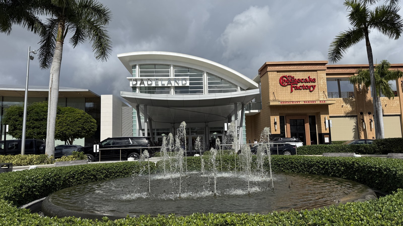
Kendall remains Miami-Dade’s largest unincorporated suburb: the core Census-designated place counted about 80,241 residents in 2020, up 6.5% from 2010, with a Hispanic/Latino share that grew from roughly 64% to 71% of the population over that decade (Source). It still has no city government of its own — no mayor, no city council, no city police department — everything runs through Miami-Dade County directly, and today “Kendall” functions more as a well-known shorthand for a huge swath of suburbia radiating out from Dadeland Mall than as a place with fixed legal borders.
Home values in Kendall
Redfin puts Kendall’s median sale price at $569,715 as of July 2026, up 12.8% year-over-year (Source); Redfin’s neighborhood-level tool has separately shown per-square-foot pricing around $363/sq ft, though an equally current figure for that specific metric wasn’t confirmable at publication time. For a wider yardstick, Zillow’s Home Value Index for the whole Miami metro area was $580,866 as of August 31, 2026, up 0.8% year-over-year (Source) — Kendall itself, as an unincorporated suburb rather than a single ZIP or city, doesn’t get its own headline ZHVI figure from Zillow. RentCafe shows average rents in the low-$1,500s in Kendall-area ZIP codes such as 33193, with one-bedrooms commonly listed between roughly $1,850 and $3,155 and two-bedrooms between about $2,195 and $3,917 a month (Source) — a wide range that reflects how much ground Kendall covers, from older garden apartments to newer mid-rises near the Metrorail line. One practical wrinkle for buyers: because Kendall is unincorporated, there is no city building department or municipal zoning code to navigate — permits, setbacks, and land-use questions all go through Miami-Dade County’s own zoning and building departments rather than a city one (Source).
Getting around
Kendall posts a Walk Score of 28 (“most errands require a car”), a Transit Score of 23 (“it’s possible to get on a bus”), and a Bike Score of 37 (“minimal bike infrastructure”) — solidly car-dependent, with what little walkability exists concentrated near Dadeland Mall and the Metrorail stations (Source).
Kendall FAQ
Is Kendall walkable?
Not really — Kendall posts a Walk Score of 28 out of 100 (“most errands require a car”), and outside the immediate area around Dadeland Mall and the Metrorail stations, it’s built for driving (Source).
Does Kendall flood?
Kendall is inland, so storm surge isn’t the main issue — the risk is the general Miami-Dade pattern of flat terrain and heavy-rain stormwater flooding rather than coastal flooding. Most of the area appears to fall in FEMA Zone X, outside the mandatory 100-year floodplain, though flood zones vary block by block (Source).
Does Kendall have its own city government?
No — Kendall is unincorporated, meaning it has no mayor, city council, or city police department of its own. It’s governed directly by Miami-Dade County, which handles its zoning, permitting, and most municipal services (Source).
Do you need a car in Kendall?
Yes, for nearly everything outside the Dadeland/Metrorail corridor. Two Metrorail stations and the South Dade TransitWay busway serve Kendall’s northern edge, but the rest of the area is a low-density, car-oriented grid (Source).
Is Kendall good for families?
Yes — it’s one of the most family-dense parts of Miami-Dade, with large stretches of single-family subdivisions, numerous M-DCPS schools, and parks like Kendall Indian Hammocks; the tradeoff is that school quality and lot size vary a lot from block to block, so it’s worth checking a specific address (Source).
What is there to do in Kendall?
Dadeland Mall and The Falls cover shopping and dining, Kendall Indian Hammocks Park and nearby Zoo Miami cover outdoor time, and the area’s sheer size means most everyday needs — groceries, gyms, restaurants — are close by, even if they require a short drive (Source).
Nearby alternatives*We're not ranking these — every neighborhood has real trade-offs, and which ones matter is up to you.
Pinecrest
Adjacent to the east — unlike Kendall, Pinecrest is its own incorporated village with large-lot zoning and tree-canopy preservation rules; Kendall has no city government of its own, governed directly by Miami-Dade County.
Palmetto Bay
South — also its own incorporated village (since 2002), generally quieter and lower-density than Kendall's larger, more commercially built-up unincorporated area.
See what makes Miami-Fort Lauderdale stand out — verified, named medical, dietary, sports, and other specialty resources you won't find in most metros.
Explore Specialty Resources →