Helotes, TX

What Helotes is actually like
The Helotes Creek valley was seasonally occupied by Native American groups for thousands of years before permanent Anglo settlement began after the Texas Revolution. By 1873 Helotes was a stagecoach stop on the Bandera Road with its own post office, and around 1880-81 Swiss immigrant Arnold Gugger opened a general store, blacksmith shop, and saloon that became the community's commercial hub. The town's name comes from the Spanish elote/olote ("ear of corn"), reflecting the area's long history of corn cultivation.
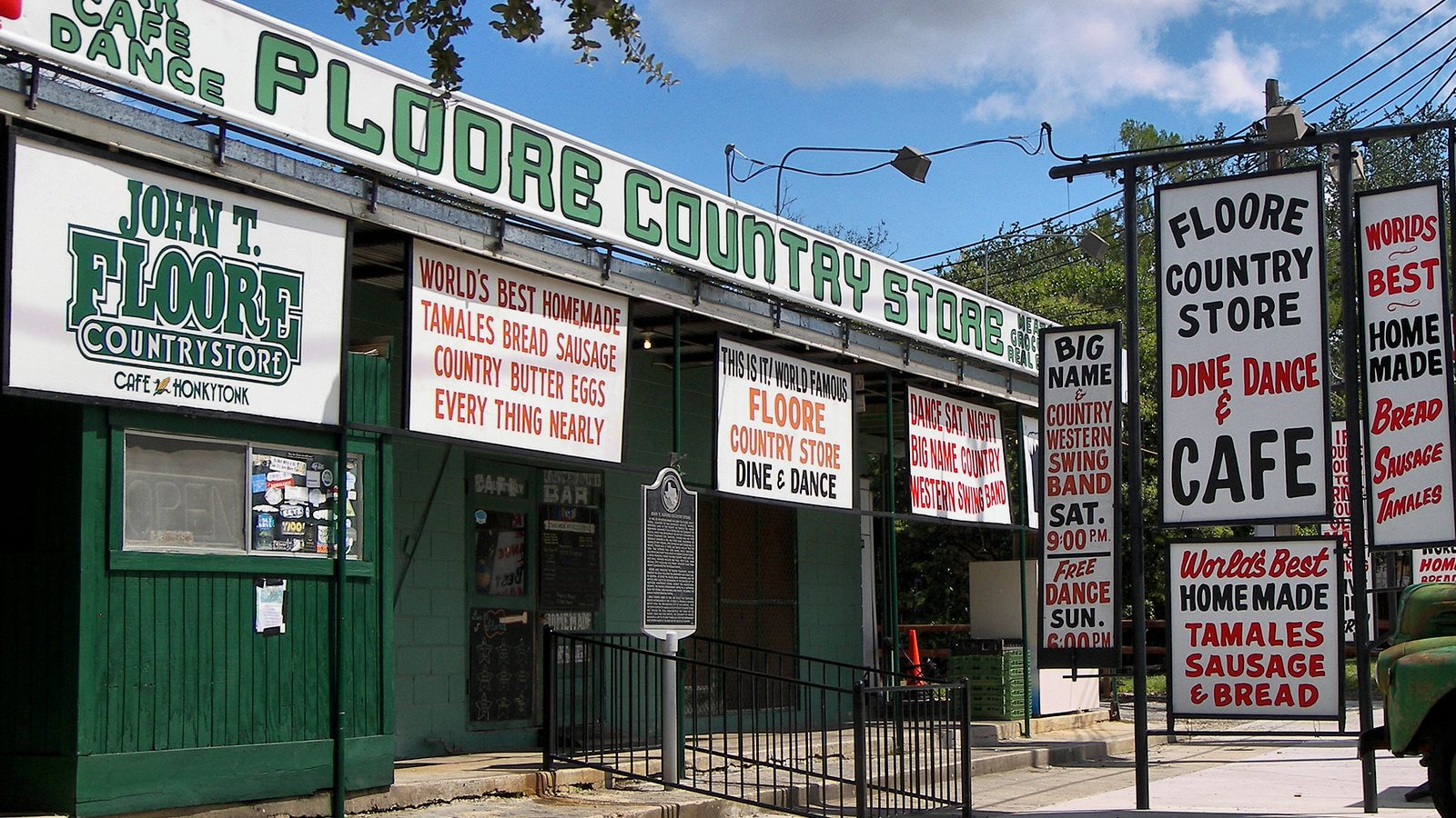
Helotes' cultural identity was cemented in 1942, when John T. Floore opened a grocery-store-turned-dance-hall on Old Bandera Road. Floore's Country Store became one of Texas's most storied live-music venues, hosting Bob Wills, Ernest Tubb, and Ray Price by the 1950s, and later serving as the launching pad for a young Willie Nelson -- giving this small town an outsized reputation in Texas country-music culture. Starting in 1966, the town also began its own Cornyval festival, celebrating its corn-farming heritage with a rodeo and carnival that now draws tens of thousands each spring.
Helotes incorporated as a city only in 1981, and its population has grown rapidly since -- from 1,535 residents in 1990 to 9,030 at the 2020 Census -- as San Antonio's suburban edge has pushed into the Hill Country. It's best described today as a growing bedroom community: newer master-planned subdivisions have spread around a small, walkable Old Town core of shops, restaurants, and Floore's, with limestone bluffs and ranch land still visible nearby, including the adjacent Government Canyon State Natural Area.
Home values in Helotes
Zillow tracks home values city-by-city, not for every neighborhood within a city — Helotes is one of the pockets that doesn't get its own figure. Rather than publish a citywide number that might not reflect this specific part of town, we're leaving pricing out of this particular guide for now.
See what makes San Antonio stand out — verified, named medical, dietary, sports, and other specialty resources you won't find in most metros.
Explore Specialty Resources →Helotes FAQ
How far is Helotes from downtown San Antonio, and what's the commute like?
About 16-20 miles northwest, typically 25-30 minutes by car in normal traffic via Bandera Road (TX-16), stretching to 35-45 minutes at rush hour. There's no VIA transit route into Helotes, so the commute is car-dependent.
Is Helotes rural, suburban, or a mix?
A mix, and a changing one. Old Town Helotes keeps a small, walkable historic core -- shops, Floore's Country Store, ranch-style properties -- while the surrounding area has filled in with newer suburban subdivisions; open Hill Country ranch land and Government Canyon State Natural Area are still nearby.
Does Helotes flood?
Helotes sits along Helotes Creek in "Flash Flood Alley" -- the karst-limestone Hill Country terrain around San Antonio is nationally recognized as flash-flood-prone, and the creek is actively gauged by NOAA/NWS for flood forecasting. No specific historic flood event tied to Helotes by name was confirmed in our research, but check FEMA/Bexar County flood maps for any specific property, especially near the creek.
What schools serve Helotes?
Northside Independent School District (NISD), one of the largest districts in Texas. Sandra Day O'Connor High School is located in Helotes itself and holds a 9/10 GreatSchools rating.
Is there public transit in Helotes?
No. Helotes never joined VIA Metropolitan Transit's service area, despite being in Bexar County, so residents rely on personal vehicles.